


Results
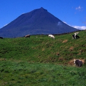
Pico (opposite Faial and São Jorge) is one of the central group of islands in the Azores. It is the second largest (446 km2) and the highest in the archipelago (2,351 m). The volcano that crowns the island is the most outstanding ...
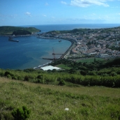
Faial (173 km2) is one of the central islands of the Azores and the fifth largest. The central peak of Cabeço Gordo is the highest point at 1,043 m. A large crater, Caldeira, surrounded by sheer walls and measuring 1.5 km in diameter is ...
Santa María (97.5 km2) is situated around 102 km from the south of São Miguel and is the easternmost island in the archipelago of the Azores. Pico Alto (567 m) is the highest point. Vila do Porto, the capital, is one of the oldest towns ...
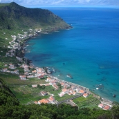
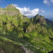
São Jorge (246 km2) is one of the central islands of the Azores. It is long (65 km) and very narrow (8 km), like a knife. The highest point is Pico da Esperança at 1,053 m, and Velas, the capital, is situated on the south coast. The two ...
São Miguel is the second easternmost island in the Azores, after Santa Maria, and is the largest of the two (757 km2). It is also the capital of the archipelago. Geologically it was formed in six volcanic stages, including the northeast ...
Terceira is one of the central islands of the Azores. It is the third largest in the archipelago (401 km2) and the highest at 1,021 m (Pico de Santa Barbara). The geomorphology is dominated by three massifs: Serra do Cume, Serra do ...
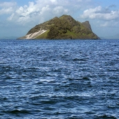
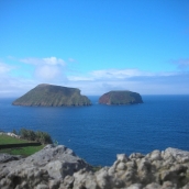
The islet of Branco (3 km2) is not far from Raso and is quite high (327 m), in relation to its small size (3,975 m long and 1,270 m wide). Seen from a distance, it resembles a fortress, rising precipitously from the sea. The terrain is ...
Raso (7 km2) is the most interesting islet in the archipelago of Cape Verde. It is situated between Santa Luzia and São Nicolau, and is close to Branco, another islet. It has an altitude of 164 m, is 3,600 m long and 2,770 m wide. The ...
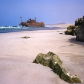
Of all the Cape Verde islands, Boavista is the closest to Africa, at just 567 km distance. It is also one of the Barlovento Islands (along with Sal and Maio). It has a surface area of 620 km2 and rises to 390 m at its highest point, Monte ...
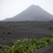
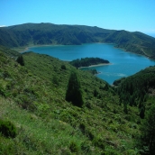
Fogo (476 km2) is part of the group of Sotavento Islands, and its highest peak, Pico Novo (2,829 m) is also the highest point in the archipelago of Cape Verde. The geography of Fogo has been greatly influenced by recent and historical ...
São Nicolau (343 km2) is one of the Barlovento group of islands of Cape Verde. The highest point is Monte Gordo, at 1,304 m, and the capital, Ribeira Brava, is located inland, unlike the capital of Brava, Nova Sintra, which is located on ...
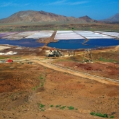
Sal (216 km2) is one of Cape Verde’s easternmost islands, along with Boavista and Maio. It is very flat with very few mountains: Monte Grande, the highest (406 m), in the north, Monte Leste and Monte Leão, on the west coast, and Monte ...


