


Geography of Fogo
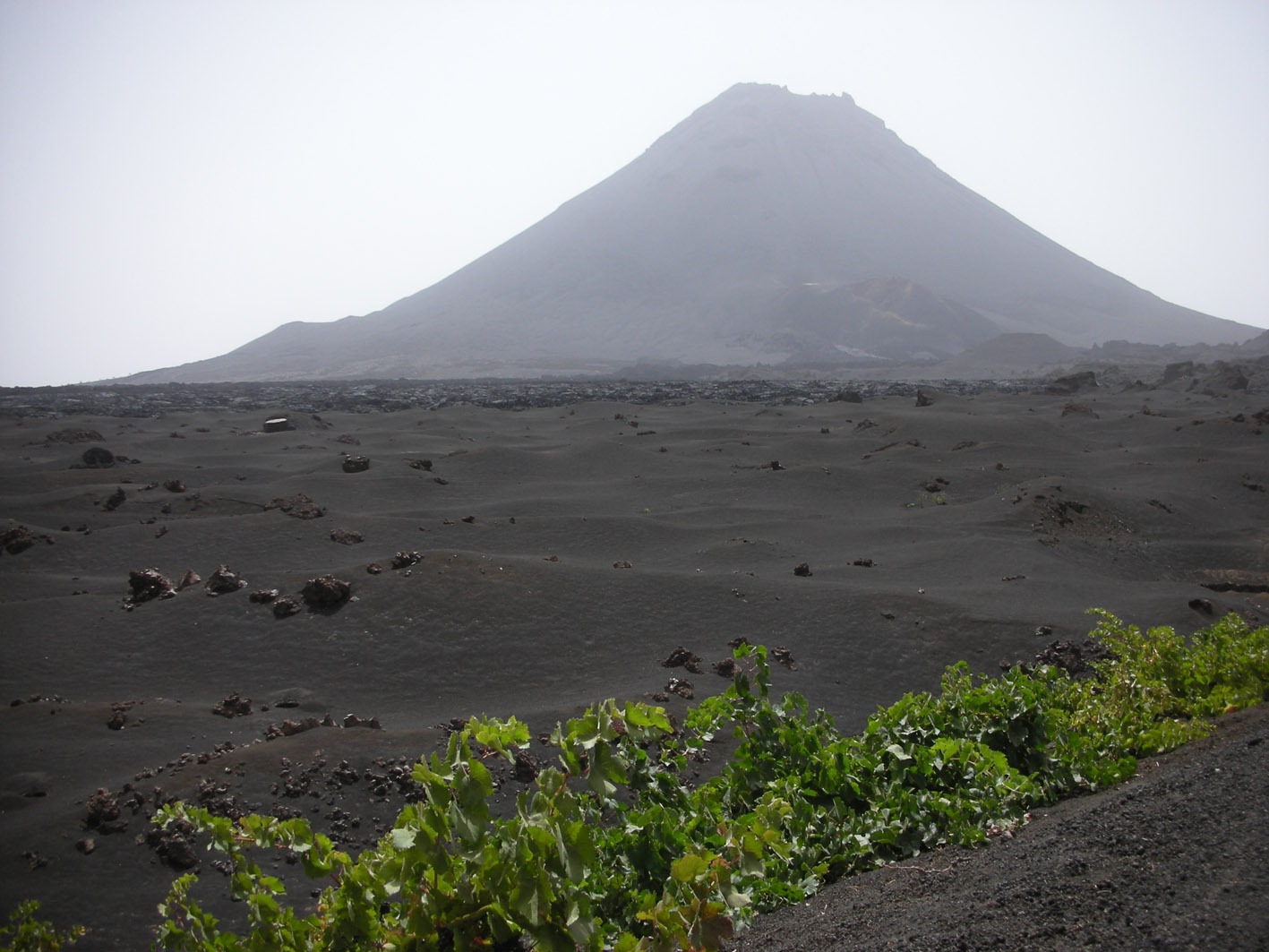
Fogo (476 km2) is part of the group of Sotavento Islands, and its highest peak, Pico Novo (2,829 m) is also the highest point in the archipelago of Cape Verde. The geography of Fogo has been greatly influenced by recent and historical volcanism—the last eruptions were in 1951 and 1995—and the landscape is dominated by tongues of lava that extend towards the sea. Apart from the stratovolcano of Pico Novo, the most outstanding geomorphological feature is the no less impressive caldera that surrounds the volcano on the western side, rising to 1,000 m asl, at its highest point, and measuring 9 km from north to south. The eastern half of the caldera slid towards the sea as the result of a large gravitational landslide. The local climate is heavily influenced by monsoon-like rains, which usually arrive between August and October and cause a dramatic transformation of the landscape. However, fronts from the north can also bring rain in winter. The dampest zones are located on the northern flank, particularly near Monte Velha, where rainfall is relatively high.