


Geography of São Miguel
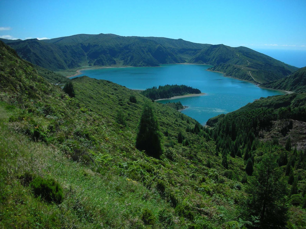
São Miguel is the second easternmost island in the Azores, after Santa Maria, and is the largest of the two (757 km2). It is also the capital of the archipelago. Geologically it was formed in six volcanic stages, including the northeast complex (the oldest zone) and Picos, of more recent volcanism. These different formations are reflected in the landscape and geomorphology, so that the oldest sectors reveal considerable gullying, with rugged valleys and ravines that have undergone centuries of heavy erosion, a fine example being Serra da Tronqueira, in the eastern section. The highest point, Pico da Vara (1,103 m), is located in the same area. Conversely, the Picos region offers a practically flat landscape and an important chain of volcanoes or cinder cones, alongside lava flows that run towards the sea. Prominent geomorphological features include lake-filled craters or calderas, some of which are quite large, such as the twin lakes of Sete Cidades, Furnas and Fogo. The coastline is made up of cliffs of varying heights, which are sometimes sheer rock faces of 200 m or more, and undulating low-lying platforms that were formed from lava flows pouring towards the sea or perhaps the occasional landslide. These platforms are known locally as fajãs or plains and there are fine examples at Mosteiros, Ponta da Ferraria and Maia. Black or grey sand beaches, mostly basaltic in origin, are dotted around the coast, and Ribeira Grande on the north coast boasts one of the largest.
The most salient feature of the climate is high rainfall, which is true of the archipelago in general and evident on São Miguel. However, since precipitation increases from east to west, islands like Flores are much wetter. Average annual rainfall in Ponta Delgada, the capital is around 1,000 mm, and in more mountainous regions it is most likely two or three times higher. An important difference between the two eastern islands and the others is the influence of the northeast trade winds, and the considerably higher sun index.