


Results
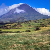
The geology of the archipelago of the Azores is complicated for two reasons: volcanic origin and geotectonic location. The archipelago is the result of volcanic activity associated with the triple junction of the lithospheric plates of ...
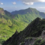
For the most part, these volcanic islands are very rugged, although the eastern islands of Sal, Boavista and Maio—which are the oldest—feature flatlands with slightly raised elevations. Nearly all the islands have well-preserved ...
Macaronesia is a (bio) geographical region made up of the Atlantic archipelagos of the Azores, Madeira, Savage and Canary Islands, and Cape Verde. From a biological perspective, however, it also includes a coastal stretch of Northwest ...
Alegranza (10 km2) is the northernmost point in the archipelago of the Canaries. This tiny islet is located north of Lanzarote and rises to nearly 300 m at La Caldera. It is privately owned but forms part of the Canary Islands’ Network ...
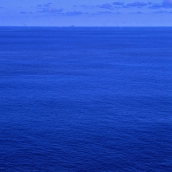
The Savage Islands are located at around 100 miles north of Punta de Anaga, in Tenerife, and almost 160 miles south-southeast of São Lourenço, in Madeira (1 mile = 1.8 km). They include three small islands (Selvagem Grande, Selvagem ...
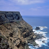
The largest (4.5 km2) and highest (151 m asl) island is an irregularly shaped plateau that is practically flat on top and has sheer sides that plunge abruptly into the sea. The higher section, roughly 100 m above sea level, is a broad ...
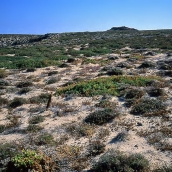
Selvagem Pequena has a surface area of 0.3 km2. This low island is mainly covered with organic sands of marine origin. Underneath are phonolitic agglomerates crossed by several dikes, as on Selvagem Grande. At the western tip there is a ...
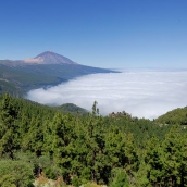
At 3,718 m altitude and with a total area of 2,058 km2, Tenerife is both the highest and largest island in all of Macaronesia. The terrain is extremely rugged, particularly in the three old massifs (Anaga, Teno and Adeje), along the north ...
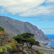
Known as the island of the zero meridian, El Hierro (268.7 km2) is the most westerly and southerly of all the Canary Islands, as well as the smallest (except for La Graciosa). It rises to a maximum altitude of 1,501 m (Pico de Malpaso), ...
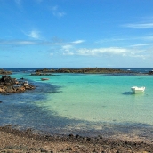
This tiny island (4.5 km2) is located to the northeast of Fuerteventura from which it is separated by La Bocaina Strait, less than 30 m deep. The highest point is La Caldera (127 m), a volcanic cone that has collapsed on the west side ...
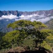
La Palma (729 km2) rises to 2,426 m at Roque de los Muchachos and is one of the most northerly and westerly of all the Canary Islands. Shaped like a triangle, its three angles end in Punta Cumplida in the northeast, Puntagorda in the ...
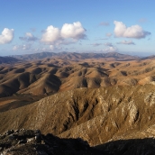
Fuerteventura (1,725 km2) is the second largest of the Canaries and one of the archipelago’s two easternmost islands. In all Macaronesia, it is the closest to continental Africa, lying just 96 km from Cape Juby, in Tarfaya, in south ...


