


Geography of Madeira Islnd
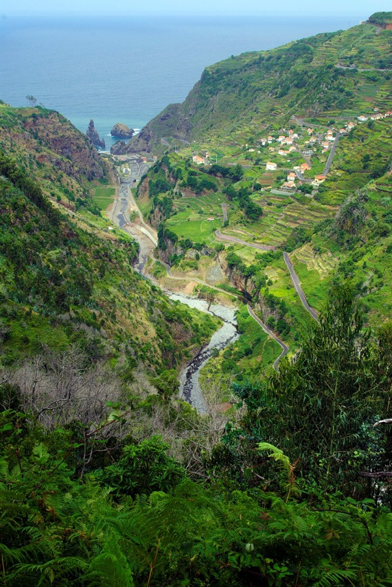
Madeira stretches over 736 km2 and is the capital island of the archipelago of the same name. Extremely rugged and scored by deep ravines, it has numerous calderas, or cauldron-like cavities, and coastal escarpments. Flatlands are few, and the main plateau is Paul da Serra (1,500 m), in the western half of the island. The coastline is generally sheer, with cliffs towering to over 200 m in some sections. The highest is Cabo Girão, which plunges in a near vertical drop towards the sea from 580 m. Natural beaches are few and mostly of pebbles and black sand, although the peninsula of Ponta de São Lourenço has a fine beach of golden sand. The highest points on the island are Pico Ruivo (1,861 m) and Pico Arieiro (1,810 m), located in the mountains in the eastern section. The great valleys of Curral das Freiras and Serra de Água are magnificent, as are the deep ravines that carry water all year round, such as Ribeira da Janela, which is the longest hydrographic basin on the island.
A marked altitudinal gradient signals Mediterranean microclimates at lower and mid-altitudes, and milder weather in higher zones. Average annual temperatures are around 15 ºC and 20 ºC, with average annual rainfall of 1,500 mm and 1,000 mm, across the northern and southern flanks, respectively. In Funchal, the island capital, average rainfall drops to 600 mm, and in some north-facing mountainous areas it can rise to 2,500-2,800 mm. Moreover, in the highest regions, temperatures can plummet to below 0 ºC, in winter and spring, often bringing frost and snow.