


Geography of Azores
The archipelago of the Azores is located at some 1,380 km from Portugal and is made up of nine islands, arranged in three groups: the eastern isles of Santa Maria and São Miguel, the central isles of Terceira, São Jorge, Graciosa, Pico and Faial, and the western isles of Flores and Corvo. The latter two are located on the American tectonic plate (not the European like the rest) and are much closer to the American continent, at 1.930 km distance from Newfoundland (Canada). São Miguel (757 km2), the capital, is the largest island, while Corvo (17 km2) is the smallest. The total surface area of the archipelago amounts to 2,344 km2 and the highest peak is found on the island of Pico (2,351 m).
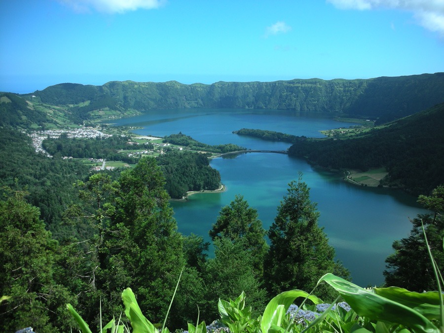
The recent origins of most of the Azores accounts for the near total absence of deep ravines, except in the east of São Miguel, one of the oldest parts of the archipelago. However, important coastal cliffs feature on all the islands, as do large calderas (particularly on São Miguel, Terceira, Faial and Flores), almost always with natural lakes, and alignments of recent volcanoes or cinder cones, which are clearly visible on São Jorge and Pico. The large central volcano on Pico, a stratovolcano like Mt Teide (Tenerife), is particularly interesting because of its size and appearance, as is Pico Novo, on Fogo (Cape Verde), although it lacks the surrounding caldera of the previous two.
The climate of the Azores is very peculiar, a fact that is suitably reflected in the name of the anticyclone that frequently affects Europe. The Azores have by far the highest rainfall of all Macaronesia, with an annual average of around 4,000 mm (e.g., on Flores), more than 1,000 mm difference compared with the highest recorded values for Madeira and three times higher than those registered in the Canaries. In any case, the annual average for the entire archipelago varies from 1,000 to 1,600 mm at sea level. Relative humidity is also very high and can reach 95% in certain areas. The sun index, however, is rather low, since the annual average number of sunny days does not exceed 73 on the two easternmost islands, despite their privileged geographical location. The sea temperature is higher than would be expected for the latitude of these islands, thanks to their geographical position, directly in the path of the warm waters of the Gulf Stream.
The marine environment of the Azores is influenced by the Azores High (or anticyclone) and the Gulf Stream, which transports relatively warm waters through this ocean zone. These islands are particularly interesting from a biological and biogeographical perspective, given their recent age and isolated position in the middle of the Atlantic.